


The weather report: Amid monsoon bonanza, UP, Bihar and Jharkhand await their due
The weather report: Amid monsoon bonanza, UP, Bihar and Jharkhand await their due
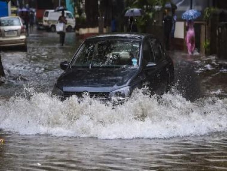
Monsoon has taken the country in its grip. Parts of Jammu, Himachal Pradesh, Uttarakhand, Punjab, Haryana, Delhi-NCR, Rajasthan, Gujarat, Madhya Pradesh, Chhattisgarh, Odisha, Telangana, Andhra Pradesh and the interiors of Maharashtra experienced normal to excess rainfall last week. Parts of Uttar Pradesh, Bihar, Jharkhand also observed an increase in rainfall spread and intensity, but were unable to recover from the ongoing rainfall deficiencies.
As per the IMD data, the following is the monsoon trend in India between 1 June and 23 July:
- India as a whole recorded a total of 410.5mm rainfall against the average of 370.9mm, a departure from normal stands at +11 per cent. A drop in pan-India rainfall departure by -2 per cent is due to reduction in the heavy rainfall over the west coast and Ghats’ sections.

- Southern Peninsula: Actual 417.0mm against the average of 311.2mm; +34 per cent departure from normal.
- East & North-East India: Actual 554.0mm against the average of 651.4mm, -15 per cent departure from normal.
- North-West India: Actual 224.1mm against the average of 227.6mm, -2 per cent departure from normal.
- Central India: Actual 509.0mm against the average of 404.0mm, +26 per cent departure from normal.
Subdivision/state-wise rainfall figures
Telangana recorded a total of 627.4mm rainfall against the normal of 286.5mm; departure from the normal stands at +119 per cent which is highest in the southern peninsula as well as pan-India.
Kerala recorded 914.7mm rainfall against the normal of 1,142.0mm; it has the highest deficiency in the South at -20 per cent below normal rains.
In Central India, Saurashtra and Kutch have the highest positive anomaly at +75 per cent, receiving a total of 411.2mm rainfall so far against the normal of 235.4mm.
In North-West India, west Rajasthan received a total of 190.9mm rainfall against the normal of 114.7mm, the highest rainfall in north India at +66 per cent.
Uttar Pradesh continues to struggle with less rains; east Uttar Pradesh recorded a total of 130.2mm so far against the normal of 317.4mm — the departure from normal stands at -59 per cent, which is the highest rainfall deficit subdivision in North-West India as well as pan-India.
In the North-East, Assam and Meghalaya has the highest positive anomaly at a total of 1044.9mm against the normal of 914.1mm, a departure from normal at +14 per cent.
Meanwhile, the Gangetic West Bengal recorded 252.3mm against the normal of 503.8mm, Jharkhand recorded 211.0mm against the normal of 426.0mm — both subdivisions have the highest rainfall deficiencies of -50 per cent from the normal.

Current Synoptic features over India as on 24 July:
• The monsoon trough at mean sea level now passes through Jaisalmer, Kota, Guna, Jabalpur, Pendra Road, Jharsuguda, Chandbali and thence south eastwards to East Central Bay of Bengal and extends up to 1.5 km above mean sea level.
• The cyclonic circulation over interior Odisha and adjoining Chhattisgarh extending up to 7.6 km above mean sea level tilting southwestwards with height persists.
• The north-south trough from South Interior Karnataka to Comorin area extending up to 0.9 km above mean sea level persists.

All-India forecast till 30 July
North India
Till Wednesday there will be isolated passing spells of moderate to intense rainfall in Uttar Pradesh, Delhi-NCR, Rajasthan, Haryana and Punjab; these short-lived showers will keep the weather warm and humid. Due to prevailing Easterlies, the moisture will remain on a higher side in the range of 50-65 per cent in the peak afternoon hours. The monsoon axis will travel northward by Wednesday or Thursday; at the same time, a weak Western Disturbance might be approaching the Himalayas.
The interaction may result in extremely heavy Rainfall over the Himalayas between 27 and 30 July. Cloudburst and landslide possibilities will be higher in Uttarakhand, Himachal Pradesh and Kashmir. At the same time, most parts of Punjab, Chandigarh, Haryana, Delhi-NCR, north Rajasthan and west Uttar Pradesh experience a round of heavy to very heavy showers.
Expected precipitation accumulation till 30 July
- Uttarakhand: 170mm
- Himachal Pradesh: 150mm
- Jammu and Kashmir: 120mm
- Punjab: 120mm
- Haryana: 110mm
- Delhi NCR: 90mm
- Uttar Pradesh: 80mm
- Rajasthan: 60mm

Central India
The low-pressure area over east Madhya Pradesh will move west and weaken gradually. Early in the week many parts of Gujarat, Madhya Pradesh and Chhattisgarh will experience heavy to very heavy rainfall under the presence of the monsoon axis. The intensity and spread of the rainfall will decrease slightly towards the end of the week as the monsoon trough is expected to shift towards North India.
Meanwhile the rainfall over Mumbai, Konkan, and Marathwada will remain subdued for the entire week as the offshore trough will remain weak on this latitude and there will be no recovery before the first week of August.
Expected Precipitation accumulation till 30 July
- Madhya Pradesh: 180mm
- Chhattisgarh: 150mm
- Maharashtra: 110mm
- Gujarat: 80mm
East and North East India
The southern movement of the monsoon trough kept the rains inactive across East and North East India during the past week. The upcoming week will also start on a weaker note as the axis remains south of its normal position but as soon as it starts shifting northwards by mid-week, rains will pick up pace across Bihar, Jharkhand, West Bengal, Sikkim and North East India.
Between 27 and 30 July, moderate to heavy rains will be observed in many parts of Odisha, Jharkhand, West Bengal, Bihar, Sikkim, whereas parts of Assam, Meghalaya, Mizoram, Nagaland, Tripura, Manipur, Arunachal Pradesh may experience spells of very heavy rains.
Expected Precipitation accumulation till 30 July
- North East India: 170mm
- Odisha: 130mm
- West Bengal: 120mm
- Jharkhand: 90mm
- Bihar 70mm
Southern Peninsula
The Monsoon Axis present over Central India will keep the monsoon in the active stage over Andhra Pradesh and Telangana till Wednesday. This will deteriorate the existing flood-like situation but rainfall activities will decrease significantly.
Once the Monsoon Axis moves northward, the rainfall activities will gradually increase over interiors and coastal Tamil Nadu including Chennai, interiors of Karnataka including Bangalore by the second half of the upcoming week. The offshore trough will once again gain strength at the west coast up to Goa, resulting in return of good rains across Goa, Karnataka and Kerala coastal areas and Ghat sections.
Expected precipitation accumulation till 23 July
- Kerala: 140mm
- Goa: 120mm
- Karnataka: 90mm
- Telangana: 70mm
- Andhra Pradesh: 70mm
- Tamil Nadu: 60mm
As we progress in the last week of July, India would have completed the 50 per cent cycle of the seasonal rains and as per the projections the country will be having an anomaly of +10 to +15 per cent above normal rains. Also, the dynamics of monsoon are such that there are a few states like Uttar Pradesh, Bihar, Jharkhand and West Bengal where the rainfall so far is half the normal.
The author, better known as the Rohtak Weatherman, interprets and explains complex weather patterns. His impact-based forecasts @navdeepdahiya55 are very popular in north India.
Read all the Latest News, Trending News, Cricket News, Bollywood News,
India News and Entertainment News here. Follow us on Facebook, Twitter and Instagram.
What's Your Reaction?


